National Famine Way: Route, Stages & Walking Guide
Planning to walk Ireland's National Famine Way? Discover the 165km route from Strokestown to Dublin, stages, history, passport, cycling and current trail information.
Stretching across Ireland from Strokestown in County Roscommon to Dublin's Docklands, the National Famine Way is one of the country's most moving long-distance trails.
It follows the footsteps of 1,490 famine emigrants who left the Strokestown Park estate in May 1847.
Their journey began on foot. From Roscommon they walked towards the Royal Canal and then followed it eastwards to Dublin. From there, they travelled to Liverpool before boarding emigrant ships bound for Canada.
Today, the route has been transformed into a 165km waymarked walking and cycling trail linking the National Famine Museum at Strokestown Park with the Famine Memorial at Custom House Quay in Dublin.
Along the way you'll find bronze children's shoes, canal towpaths, historic villages, old harbours, locks, bridges, famine-era stories, and some of the quietest countryside in Ireland's Hidden Heartlands.
It's one of those trails where the landscape matters. But the story matters even more.
2026 Trail Updates: Works connected with the new N5 and Strokestown Bypass may cause diversions near the start of the trail — check the official route map before setting off. Cyclists should note a ~5km diversion around Castleknock/Clonsilla (the Deep Sinking section) — leave the signed walking route at Porterstown Bridge and follow the road diversion, rejoining around the 12th Lock.
Where Does the National Famine Way Start?
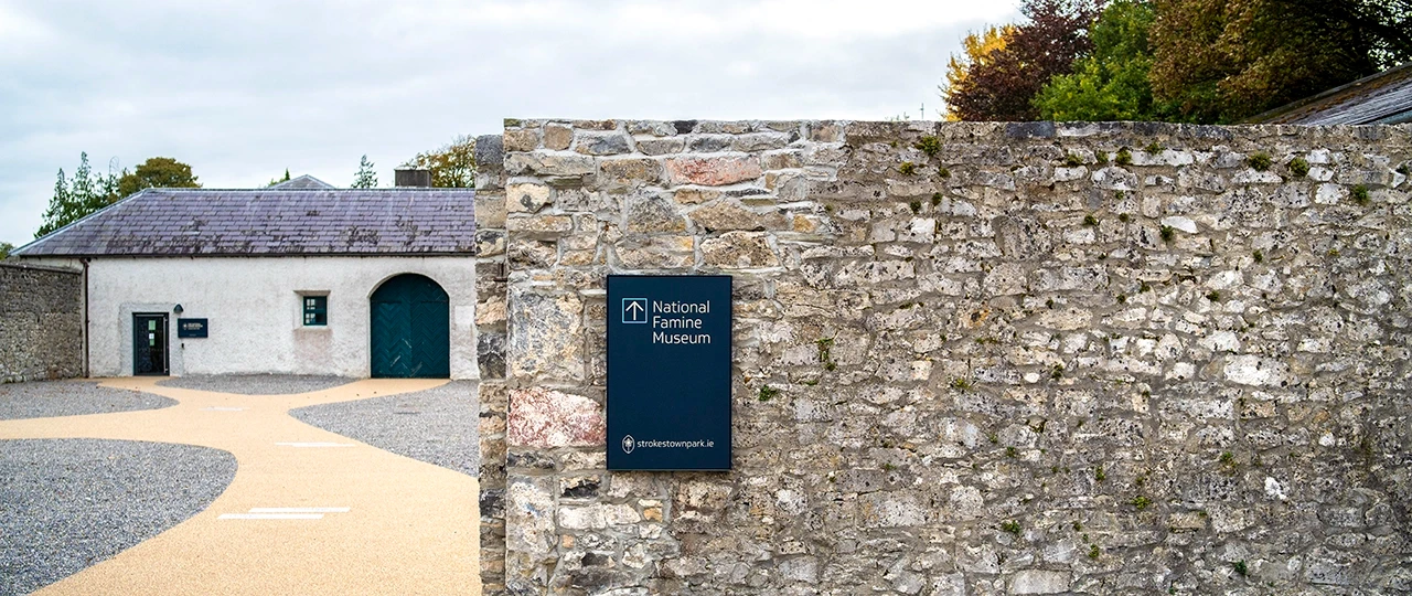
The trail officially begins at the Glass Memorial Wall at Strokestown Park House in County Roscommon. The first pair of bronze shoes stands here beside the National Famine Museum.
If you're walking the complete route, visit the museum before setting off. It gives context to everything you're about to experience — who the 1,490 were, why they left, what conditions were like during the Great Famine, and what happened to many of them afterwards.
Without that background, the trail is a pleasant canal walk. With it, the entire journey feels very different.
Where Does the Famine Way Finish?
The route finishes in Dublin Docklands, at the Famine Memorial close to EPIC The Irish Emigration Museum, the Jeanie Johnston, Custom House Quay, and the River Liffey.
That ending is deliberately symbolic. You begin beside the estate those families were forced to leave. And finish beside the docks from which emigrants departed Ireland.
How Long is the National Famine Way?
The official National Famine Way organisation gives the route as approximately 165km (roughly 100 miles). Sport Ireland maps it slightly longer at 168.6km due to differences in route measurement.
How Long Does it Take?
The official route planner recommends approximately 7–13 days for the complete trail. For most recreational walkers, we'd recommend 8–10 walking days — enough time to actually experience the history rather than simply counting kilometres.
Is the Famine Way Difficult?
Technically, no. The official trail is graded Easy because there are no major mountain climbs, most gradients are very gentle, and much of the route follows level canal towpaths. The difference between start and finish elevations is only around 40 metres.
But walking 20–30km every day is still demanding. The National Famine Way itself describes the full 165km journey as strenuous because of the repeated long walking days.
What is the Route Like?
The first section is quite different from the rest. From Strokestown to Clondra, the trail follows roughly 20km of country roads. Once you reach Clondra, everything changes — the remaining roughly 145km follows the Royal Canal towards Dublin. Flat, traffic-free, easy to navigate, and extremely peaceful.
The Royal Canal
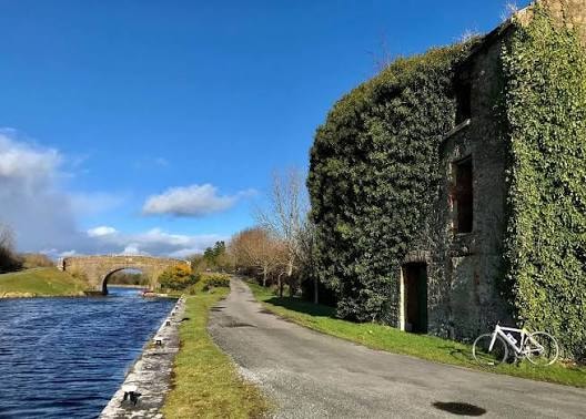
The Royal Canal is essentially the backbone of the National Famine Way. Once walkers reach Richmond Harbour in Clondra, they follow the canal eastwards through County Longford, Westmeath, Meath, Kildare, and Dublin.
The canal once carried passengers, goods, livestock, and commercial traffic between Dublin and the River Shannon. Today you're more likely to encounter cyclists, walkers, swans, herons, and the occasional person beside a fishing rod who looks like they've been there since 1987.
The Story of the 1,490
This is what separates the National Famine Way from almost every other long-distance trail in Ireland.
In May 1847, during the worst year of the Great Famine, 1,490 tenants from the Strokestown Park estate were forced to emigrate. They were escorted on foot towards Dublin. The reasoning was brutal — assisting their emigration was cheaper for the landlord than supporting them in the local poorhouse.
Two-thirds of the 1,490 were women and children.
What Happened After Dublin?
Reaching Dublin was only the beginning. The emigrants travelled by packet steamer to Liverpool, then were placed aboard four vessels bound for Canada: Erin's Queen, Naomi, The Virginius, and The John Munn.
Conditions aboard many famine emigrant vessels were horrific. Disease spread quickly. Food and sanitation were inadequate. Research connected with the National Famine Way suggests more than one-third of the Strokestown 1,490 died during the wider journey towards Canada.
The Bronze Shoes
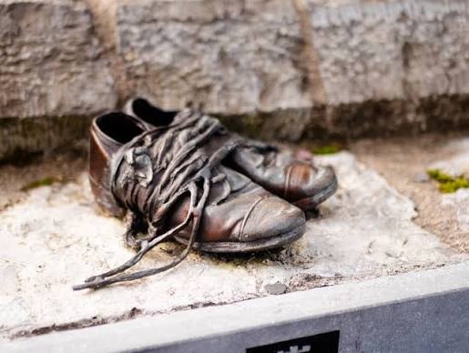
The symbol of the National Famine Way is a pair of children's shoes cast in bronze. There are now 32 pairs along the route. At each one, the official app provides audio, video, local history, and another part of Daniel Tighe's story.
The original shoes that inspired the sculptures were discovered hidden in the roof of a ruined 19th-century cottage near Strokestown. When you see children's shoes beside a 165km trail, the distance suddenly feels different.
Daniel Tighe
One of the people remembered along the trail is Daniel Tighe — just 12 years old when he walked from Strokestown towards Dublin in 1847. His experience has been reimagined in a digital story written by Irish author Marita Conlon-McKenna. Through the official Famine Way app, walkers hear parts of Daniel's story at locations along the route. Instead of 1,490 statistics, you follow one child.
Waymarking
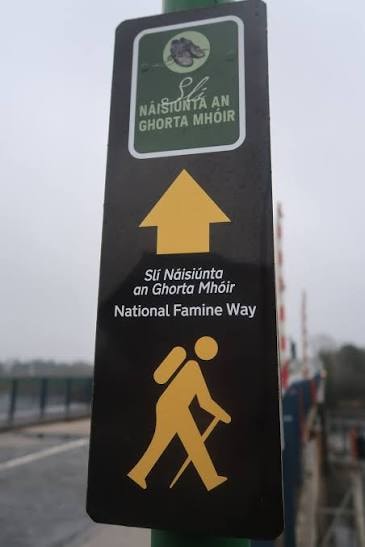
The route is clearly marked with the familiar yellow walking figure and arrow on a black background. The bronze shoes provide additional historical waypoints. Navigation is generally straightforward once you reach the Royal Canal. Pay particular attention to waymarkers between Strokestown and Scramogue at the very beginning.
Recommended 9-Day Route
The official National Famine Way trip planner offers several itineraries. For most walkers, the nine-day version strikes a nice balance.
Day 1 – Strokestown: Arrive and visit the National Famine Museum, Strokestown Park House, gardens, and Glass Memorial Wall. Start the trail fresh the following morning.
Day 2 – Strokestown to Clondra: Approximately 20km through rural County Roscommon towards the River Shannon. Services are limited between Strokestown and Tarmonbarry — bring food and water. Your destination is Clondra / Richmond Harbour, where the Royal Canal meets the Shannon and the walk changes completely.
Day 3 – Clondra to Ballymahon Area: Approximately 23.5km along the Royal Canal through quiet Longford countryside. Nearby Corlea Trackway Visitor Centre is a worthwhile diversion — an extraordinary Iron Age bog road dating back more than 2,000 years. Farther east, Abbeyshrule is one of the most pleasant canal-side villages on the entire route.
Day 4 – Ballymahon Area to Ballynacarrigy: Approximately 17.7km. A shorter day giving your legs some breathing room as you continue east along canal towpaths into County Westmeath.
Day 5 – Ballynacarrigy to Mullingar: Approximately 19km. A lovely canal day ending at Mullingar Harbour — the natural halfway hub of the trail. Mullingar has accommodation, restaurants, shops, and public transport. The official Famine Way FAQ recommends considering a rest day here. We agree.
Day 6 – Mullingar to Hill of Down: Approximately 25km — one of the longer stages. The canal continues east into County Meath. Hill of Down's old railway station opened in December 1847, only months after the Strokestown emigrants made their journey on foot.
Day 7 – Hill of Down to Enfield: Approximately 15km. A shorter stage through rural Meath. Enfield has connections with famine-era history, including a surviving famine pot associated with relief efforts.
Day 8 – Enfield to Maynooth: Approximately 19km. The surroundings become gradually more suburban as you pass through Kilcock and the Carton Estate area towards Maynooth — your final major overnight stop before Dublin. Maynooth Castle, St Patrick's College, restaurants, pubs, and train connections all await.
Day 9 – Maynooth to Dublin Docklands: Approximately 27km. A long final day. The canal becomes increasingly urban as you pass Leixlip, Clonsilla, Castleknock, and Ashtown before the route leaves the canal and continues to Custom House Quay, the Famine Memorial, and the end of the National Famine Way.
The Deep Sinking
Between roughly Clonsilla and Castleknock, the Royal Canal passes through an area known as The Deep Sinking — narrower, rougher, unpaved, and bordered by steep canal banks. Take care here. This section is currently not suitable for wheelchairs, buggies or bicycles. Cyclists should follow the designated road diversion from Porterstown Bridge.
The Finish in Dublin
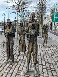
The end is deliberately emotional. You'll reach Rowan Gillespie's Famine Memorial figures at Custom House Quay — gaunt bronze figures walking towards the ships. Nearby are EPIC The Irish Emigration Museum, the Jeanie Johnston, the Custom House, and the River Liffey.
After 165km of following the story, standing here hits differently.
National Famine Way Passport
The official pack currently costs €20 and includes a personalised ship ticket, 14-page Passport and Guide, OSI trail map, family connection, end-of-trail booklet, and completion certificate. Along the route you collect stamps — one per county. At EPIC in Dublin, you can discover what happened to your assigned emigrant family and receive a Certificate of Completion. For anyone walking the complete route, we'd absolutely buy it.
Buy Now — National Famine Way Passport
Free National Famine Way App
The official app is free. It uses your location to trigger stories around the bronze shoes, with local famine history, audio, video, interviews, and Daniel Tighe's story. Download it before starting — some rural sections may not have perfect mobile reception.
National Famine Museum
If you're doing the full walk, start here. The National Famine Museum at Strokestown Park contains original archival material preserving the identities and stories of the 1,490 emigrants.
Current 2026 opening: Daily, 10:30am–5pm (note a special closure on 20 October 2026). Guided Strokestown Park House tours run at 12pm and 2pm. Visit the museum the day before you set off.
Read our full guide to Strokestown Park
Accessibility and Families
The National Famine Way is surprisingly accessible. Strokestown to Maynooth is entirely buggy friendly and many sections are wheelchair accessible. However, the Deep Sinking between Clonsilla and Castleknock is not wheelchair or buggy friendly, and some Maynooth–Clonsilla sections are undergoing surface improvements.
For families, short canal sections around Mullingar Harbour or Maynooth / Kilcock are excellent choices — traffic-free towpaths, interesting locks, boats, birdlife, and the bronze shoes.
Dogs
Yes — the National Famine Way is dog friendly. Keep dogs under control around other walkers, cyclists, wildlife, livestock areas, and canal edges. Note that rubbish bins aren't available all along the trail, so be prepared to carry waste.
Can You Cycle the Famine Way?
Yes. Most of the route is suitable for cycling and from Clondra eastwards it overlaps with the Royal Canal Greenway. Remember the current Deep Sinking cycling diversion near Castleknock. But don't treat it purely as a speed challenge — stop at the bronze shoes and listen to the stories. That's the point.
Accommodation
Book ahead. The official National Famine Way strongly recommends advance reservations. Obvious overnight areas include Strokestown, Clondra / Longford area, Ballymahon, Ballynacarrigy, Mullingar, Hill of Down, Enfield, Maynooth, and Dublin.
Annual Remembrance Walk
The next supported National Famine Way Remembrance Walk is scheduled for 16–23 May 2027, covering the route over nine days. It begins with a traditional Canadian Wake at Strokestown Park. Walkers can join the full journey or selected sections.
Best Time to Walk
The official guidance says most complete-route walkers choose spring through autumn:
- April & May — excellent, with meaningful timing around the anniversary of the original May 1847 journey
- June — long daylight, good for long stages
- July & August — warmest period, more cyclists and canal users
- September — probably our favourite; cooler walking temperatures and still good daylight
- October — still possible, but 20–30km days become harder as daylight shortens
Is the National Famine Way Worth Walking?
Absolutely. But it's very different from something like the Wicklow Way.
You aren't doing this for mountain summits, huge climbs, or wilderness. You're walking through ordinary roads, canal towpaths, towns, villages, and countryside. That's precisely what makes it powerful.
The people who made the original journey weren't hikers. They weren't carrying expensive waterproof jackets. They weren't doing a challenge. They were families leaving their homes because their survival depended on it.
Following that route slowly — especially while listening to their stories at the bronze shoes — turns an otherwise peaceful canal walk into something much deeper.
Travel Through Ireland Tip
Don't rush this one. You can physically walk the National Famine Way in seven long days, but we'd aim for 8–10 days if time permits.
Visit the National Famine Museum before you start. Download the free app. And get the €20 Passport Pack if you're doing the full route.
At each bronze pair of shoes? Stop. Listen. That's the part you'll remember.
And if you only have one day? Choose a 10–20km Royal Canal section and experience a small part of it. You don't need to walk 165km for the history to make an impact.
Start: Strokestown Park, County Roscommon | Finish: Dublin Docklands | Distance: Approximately 165km / 100 miles | Counties: Roscommon, Longford, Westmeath, Meath, Kildare and Dublin | Recommended duration: 7–13 days | Our recommendation: 8–10 days | Official grade: Easy for individual sections | Full-route difficulty: Strenuous due to repeated long distances | Bronze shoes: 32 pairs along the route | Official app: Free | Passport pack: €20 | Cycling: Yes, with current Deep Sinking diversion | Dogs: Yes, under control | Best months: April–September | 2027 Remembrance Walk: 16–23 May
Explore Topics
Written by
Travel Through Ireland
Content creator and writer sharing insights and stories.