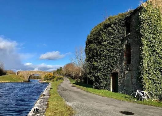
Wicklow Way: Route, Stages & Complete Walking Guide
Planning to walk the Wicklow Way? Discover the 128km route, stages, difficulty, transport, Glendalough, accommodation tips and the latest 2026 trail update.
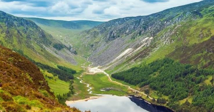
Beginning in the suburbs of Dublin and finishing more than 120km later in a small County Carlow village, The Wicklow Way is Ireland's oldest and one of its most famous long-distance walking trails.
It starts surprisingly gently.
Marlay Park. Woodland. South Dublin disappearing behind you.
Then things change.
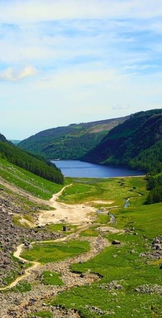
Heather-covered mountains. Blanket bog. Forest tracks. Deep glacial valleys. Lough Tay. Glendalough. Glenmalure. And finally the softer farmland of south Wicklow and Carlow.
Sport Ireland currently lists the official route as 128.1km with 3,220 metres of ascent and a Strenuous grading.
It's a serious multi-day walk. But you absolutely do not need to complete all 128km to enjoy it. Some of the best sections of the Wicklow Way work brilliantly as individual day walks.
2026 Trail Update: Sport Ireland currently has an active reroute in place around Drumgoff, near the middle of the trail, due to forestry operations. The temporary route follows the Clohernagh Brook for both northbound and southbound walkers. Signage is in place but the terrain is uneven — take extra care.
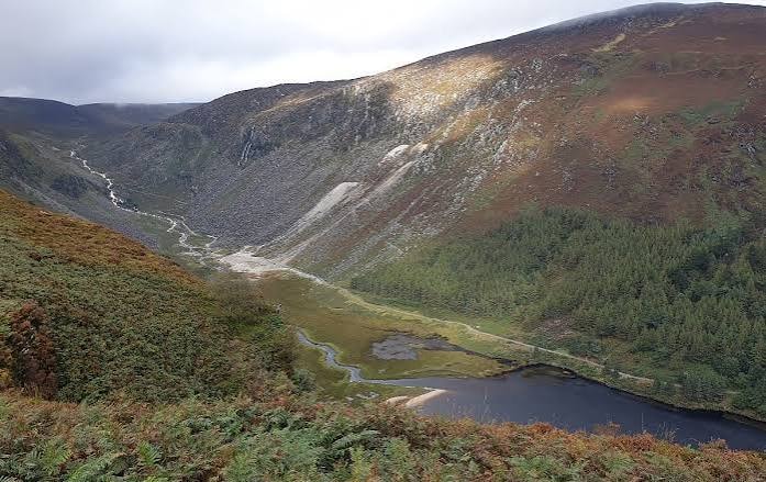
Where Does the Wicklow Way Start?
The traditional northern trailhead is at Marlay Park, Rathfarnham, South Dublin. From there the Wicklow Way heads south through the Dublin Mountains before crossing into County Wicklow.
The official southern finish is Clonegal, County Carlow.
That makes the Wicklow Way unusual among Ireland's famous long-distance trails. You can effectively start walking from Dublin's suburbs and within a few hours feel a very long way from the city.
Ireland's First Waymarked Trail
The Wicklow Way was Ireland's first long-distance waymarked walking trail. Its popularity isn't difficult to understand. It combines easy transport from Dublin, mountain scenery, historic sites, forests, lakes, villages, and some of the most famous landscapes in County Wicklow.
For international visitors who want one multi-day hike without travelling to the far west, it's an excellent choice.
How Long is the Wicklow Way?
Sport Ireland currently gives 128.1km. The dedicated Wicklow Way route guide describes it as 127km. That tiny difference is simply down to mapping and route measurement.
For practical purposes: approximately 128km.
How Long Does it Take?
Sport Ireland gives a walking time of around 6 days. The Wicklow Way route guide recommends 7+ days. For most recreational walkers, we'd lean towards 7–8 walking days.
Six is perfectly possible if you're fit and comfortable with consecutive long days. Seven or eight lets you slow down at viewpoints, explore Glendalough properly, take proper lunch breaks, and avoid turning the entire thing into a march.
Is the Wicklow Way Difficult?
The complete trail is officially graded Strenuous. That doesn't mean every section is technically difficult — most of the route is walking rather than scrambling. The challenge comes from distance, repeated climbing, uneven mountain ground, bog, mud, weather, and walking day after day.
A fit regular walker should find it manageable with proper preparation.
Wicklow Way Markers
The trail is waymarked using the familiar yellow walking person and directional arrow on a black background. The route is generally well marked, but we'd still carry offline mapping, a trail map, and a charged phone. Waymarkers can be damaged, obscured, or missed entirely when you're chatting and confidently walking in the wrong direction.
The Wicklow Way Stages
There is no single law saying exactly where you must finish each day — accommodation availability often determines stage lengths. But a traditional north-to-south itinerary looks something like this.
Stage 1 – Marlay Park to Knockree
Distance: Approximately 21km | Ascent: Around 600m | Time: Around 7 hours
The route begins at Marlay Park before leaving suburban Dublin behind. You'll climb through the Dublin Mountains, passing areas around Kilmashogue, Two Rock, Tibradden, and Prince William's Seat. The trail eventually drops towards Knockree and the Glencree Valley.
This first day is quite a statement. You begin in Dublin. By evening, you're properly in the mountains.
Marlay Park is an easy trailhead — the Wicklow Way transport guide recommends Dublin Bus Route 16, which runs from the city towards Marlay Park, with a stop close to the park entrance. That means you don't need a car waiting at the beginning.
Stage 2 – Knockree to Roundwood
Distance: Approximately 18km | Ascent: Around 500m | Time: Around 6½ hours
This is one of the most scenic sections of the entire trail. The route passes Crone Wood, views towards Powerscourt Waterfall, open mountain country, Djouce Mountain, White Hill, and spectacular views towards Lough Tay.
You'll also cross raised boardwalk sections protecting the fragile blanket bog. If you only ever walk one northern stretch of the Wicklow Way, this area should be high on your list.
The Wicklow Way doesn't take you directly over Djouce's summit — instead it crosses around its eastern side, giving you dramatic open-mountain scenery without requiring every long-distance walker to make an additional summit climb.
Lough Tay, often nicknamed the Guinness Lake because of its dark water and pale beach, is one of the classic Wicklow Way viewpoints. Camera out. Backpack down. Snack mysteriously disappears. Standard hiking procedure.
Roundwood is a useful overnight stop with accommodation, pubs, food, and shops. The official route passes close to the village rather than directly through every central street, so check your accommodation location before arriving tired and discovering you've casually added another 3km.
Stage 3 – Roundwood to Glendalough
Distance: Approximately 12km | Ascent: Around 350m | Time: About 4 hours
This is one of the easiest traditional stages. And that's ideal, because your destination is Glendalough.
Rather than racing onward, use the shorter day to explore one of Ireland's great historic landscapes. The Wicklow Way reaches Glendalough, famous for its early Christian monastic settlement, round tower, two lakes, glacial valley, and mountain trails.
If you're walking the full Wicklow Way, this is where we'd seriously consider a rest afternoon — or even a rest day.
Nearby Laragh is another practical stop with accommodation, restaurants, shops, and pubs. By day four, a supermarket can feel like Disneyland.
Stage 4 – Glendalough to Glenmalure
Routes and accommodation choices cause exact daily distances to vary, but walkers commonly cover around 15–17km between the Glendalough area and Glenmalure. Expect forest, open mountain scenery, steady climbs, remote valleys, and much less tourist traffic once Glendalough disappears behind you.
Glenmalure is one of Ireland's longest glacial valleys, deeply connected with Irish history and mountain walking. The Wicklow Way passes through this spectacular landscape before continuing south.
Important 2026 note: The active Drumgoff reroute affects this section. Follow the temporary signs along the Clohernagh Brook and take extra care on the uneven terrain.
Stage 5 – Glenmalure to Moyne
Distance: 21km | Ascent: 550m | Time: Around 7 hours
The route climbs through the slopes of Slieve Maan, touches sections of the Military Road and continues south through quieter mountain country. This is where the Wicklow Way begins changing character — the dramatic northern mountains gradually give way to rolling hills, forestry, country lanes, and farmland.
Iron Bridge at Aghavannagh is sometimes used as an alternative overnight stopping point, approximately 75km from Marlay Park. Accommodation close to the route is limited here — the southern Wicklow Way isn't lined with hotels every 10km. Advance booking, taxi transfers, or collection by your guesthouse may be required.
By Moyne, you've covered roughly 84km from Marlay Park. From here south, the trail moves increasingly through quiet lanes, forested hills, and gentler countryside.
Stage 6 – Moyne to Shillelagh
Distance: Approximately 21km | Ascent: Around 500m | Time: Around 7 hours
The terrain is generally gentler than the northern mountains. The route winds through rural south Wicklow towards Shillelagh. And somewhere along the way, near Stranakelly, you'll find The Dying Cow — a pub the Wicklow Way route guide specifically highlights around the point where walkers cross the 100km mark. A celebratory pint seems reasonably defensible.
Final Stage – Shillelagh to Clonegal
Distance: Approximately 19km | Ascent: Around 300m | Time: Around 6 hours
The trail continues through Raheenakit Forest, rolling hills, and the Derry River valley before crossing towards County Carlow. Then eventually: Clonegal. Finished.
Clonegal marks the official southern end of the Wicklow Way. Unlike Marlay Park, public transport from the trailhead isn't quite as simple. One practical option is to reach Kildavin, around 3km from Clonegal, where services towards Dublin operate. Bunclody, around 5km away, is a larger nearby town with more services. Don't finish 128km of hiking and only then discover you've absolutely no idea how you're leaving.
Can You Walk South to North?
Absolutely. The traditional direction is Marlay Park → Clonegal, but the official route guide makes a good argument for walking Clonegal → Dublin. The southern stages are gentler, giving your legs a few days to warm up before tackling the bigger Wicklow Mountain sections. And your finish? Dublin — with hotels, transport, restaurants, and roughly 4,000 opportunities to celebrate.
For scenery and the traditional experience, we'd still choose north to south. The dramatic mountains arrive early and Glendalough sits beautifully around the middle of the journey.
Best Sections for a Day Walk
You do not need a week. Several sections work brilliantly independently:
- Marlay Park into the Dublin Mountains — easy access from Dublin and a great introduction
- Crone Wood towards Djouce — mountain scenery and Powerscourt views
- Djouce / White Hill / Lough Tay — probably among the most spectacular Wicklow Way landscapes
- Roundwood to Glendalough — around 12km and relatively manageable
- Glendalough towards Glenmalure — beautiful mountain country and much quieter than Glendalough itself
Wicklow Way With Children
The complete trail isn't something we'd casually recommend to young children — it's a strenuous multi-day route with long distances and exposed sections. But individual stretches? Absolutely. Families can choose shorter sections around Glendalough, Roundwood, Marlay Park, or forest sections close to road access. Match the section to the child's walking experience rather than simply choosing the prettiest photograph.
Dogs
Sport Ireland currently lists Dogs Allowed: No for the Wicklow Way. The route passes through working farmland, livestock areas, private land, and sensitive upland habitats. Do not assume that because one local woodland permits dogs, you can bring one for the entire trail.
Accommodation
This is one of the most important things to book ahead. Popular stopping areas include Knockree, Roundwood, Laragh, Glendalough, Glenmalure, Aghavannagh, Moyne, Tinahely, Shillelagh, and nearby towns or villages. Some accommodation providers offer trail collection, morning drop-off, and luggage transfers.
You don't necessarily have to carry seven days of belongings on your back. Several accommodation providers and walking companies offer luggage transfers between overnight stops. A 7kg daypack feels very different from a 15kg backpack by day five.
Food, Water and Footwear
Do not assume cafés exist directly on the trail every few kilometres. Some stages are remote. Carry enough water, lunch, snacks, and an emergency food reserve. Where possible, buy supplies in Roundwood, Laragh, and other towns before leaving.
Waterproof walking shoes or boots are the sensible option. Sport Ireland warns that some stretches can be wet and muddy. Trail runners can work for experienced hikers during dry weather — but this is Wicklow. Dry ground is not a legally binding promise.
Weather and Navigation
The Wicklow Mountains create their own weather. A pleasant morning in Dublin does not guarantee conditions around Djouce, Glendalough, or Glenmalure. Bring a waterproof jacket, extra warm layer, hat, and protection for your backpack — even during summer.
The trail is waymarked, but carry a proper route map, GPS mapping, or offline maps — preferably a combination. And because reroutes can happen (like the current Drumgoff diversion), always check trail notices before setting off.
For an emergency in Ireland, call 112 or 999 and ask for Mountain Rescue where appropriate.
Best Time to Walk the Wicklow Way
For a full multi-day hike, we'd generally choose May to September:
- May — good daylight without peak-summer crowds; one of our favourite months
- June — longest days and excellent conditions when the weather behaves
- July & August — warmest period and busiest; midges may appear around still evenings
- September — arguably superb; cooler temperatures and autumn colours beginning
- October — still very walkable for experienced hikers, but days are shorter and weather increasingly changeable
Winter walking is possible for experienced walkers, but becomes a much more serious undertaking with short daylight, mud, high winds, poor visibility, and reduced services.
Is the Wicklow Way Worth Walking?
Absolutely. Especially if you want your first taste of long-distance walking in Ireland.
Few trails let you start so close to a capital city and transition so quickly into genuinely wild-looking mountain scenery. Within the same journey you'll experience Dublin suburbs, mountain forests, open bog, lakes, ancient monasteries, glacial valleys, tiny villages, farmland, and finally County Carlow.
After several days on foot, it absolutely feels like a proper journey.
Travel Through Ireland Tip
Don't automatically try to squeeze the Wicklow Way into six days just because the official trail listing says it can be done. For most visitors, we'd choose 7–8 days. And if time allows, give yourself an easier day around Glendalough — that's one of the most beautiful parts of the entire route. It deserves more than "Nice round tower. Anyway, another 20km to go."
Also remember the current 2026 Drumgoff forestry diversion. Follow the temporary signs along the Clohernagh Brook and take extra care on the uneven ground.
Start: Marlay Park, Dublin | Finish: Clonegal, County Carlow | Official length: 128.1km | Approximate ascent: 3,220m | Official grade: Strenuous | Typical duration: 6–8 days | Traditional direction: North to south | Dogs: No for the complete official trail | Main highlights: Djouce, Lough Tay, Glendalough and Glenmalure | Best months: May–September | Current 2026 notice: Drumgoff reroute due to forestry works
Explore Topics
Written by
Travel Through Ireland
Content creator and writer sharing insights and stories.